Showing posts with label map. Show all posts

Wednesday, February 20, 2013

Cycling in KL - feature by The Star (Living)

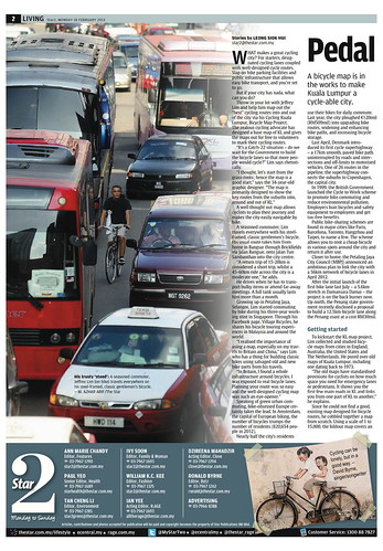
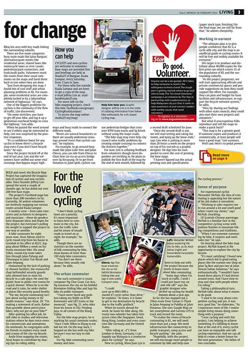
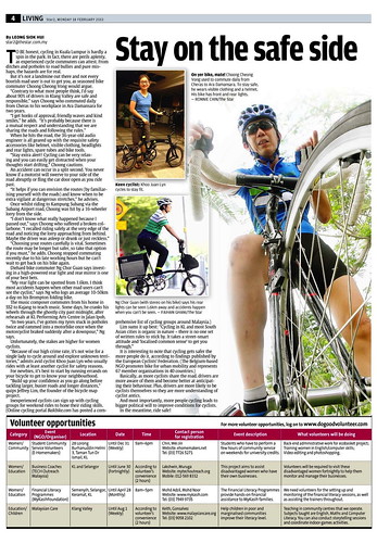
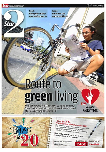
The Star's (Malaysia) Living section ran a three-page spread of the Cycling Kulala Lumpur, Bicycle Map Project on Monday.

The links to the articles begin with "Pedal for change," by Leong Siok Hui. The Star, 18 Feb 2013.
See also

Sunday, January 02, 2011

Bike Maryland Symposium 2010 videos

Bike Maryland Symposium 2010 videos and presenter slides are available here
Symposium 2010 Video, Presenter Information and Slides - Bike Maryland


Just take a look at the diversity of titles and issues addressed! Perhaps LTA sould send someone to attend the 2011 symposium in February!

  • "Maryland Department of Transportation: A Greener Way To Go." Presented by Secretary Beverley Swaim-Staley.
  • "Public Health and Transportation: Exploring the Inextricable Link
    Presented by Keshia M. Pollack, PhD, MPH; Assistant Professor, Department of Health Policy and Management, Johns Hopkins Bloomberg School of Public Health.
  • "Commuter Choice Maryland and Commuter Connections." Presented by Buddy Alves, Senior Marketing Specialist, Commuter Choice Maryland, Maryland Transit Administration and Nick Ramfos, Director, Commuter Connections, Metropolitan Washington Council of Governments.
  • "One Less Car’s Legislative Bike Agenda." Presented by Greg Hinchliffe, Chairman, Mayor's Bicycle Advisory Committee and Chair of the Maryland Committee of East Coast Greenway; Adiva Sotzsky, Dedicated Advocate.
  • "Bicycling!." Presented by Alex Obriecht, owner of 5 Race Pace/Bella Bikes bicycle shops in MD; 32 years in business; honored as a ‘Trek Legend’ and much more.
  • "Transportation for Maryland." Presented by Jennifer Bevan-Dangel, 1000 Friends of Maryland Deputy Director.
  • "Bicycling Advocates of Howard County (BAHC)." Presented by Jack Guarneri, BAHC President.
  • "Maryland’s Interactive Trail Map." Presented by Sylvia Ramsey, Manager, Community Enhancement Programs.
  • "Maryland’s Safe Routes to School Program: Building transportation alternatives today for our children’s tomorrow.." Presented by Joe Pelaia, Maryland’s Safe Routes to School Program Coordinator, Maryland State Highway Administration, Maryland Highway Safety Office.
  • "Campaign for Active Transportation." Presented by Kartik Sribarra, Manager of Policy Outreach, Rails-to-Trails Conservancy.


For videos and slides, visit Bike Maryland.

Wednesday, December 29, 2010

Yokota Fritz's Cyclelicious bike route application now works for Singapore

Yokota Fritz wrote to say his "bike route application now works for Singapore. The routing engine is from MapQuest, and cycleway data comes from OpenStreetMap project, so if there are mistakes or shortcomings, users can fix the map info directly and quickly."

Head over to try it out at cyclelicio.us/map and let us know what you think. I gave it a quick look for Holland Village to Changi Village and this is what it spat out; I like the elevantion and biccle relevant directions and timing. Google Maps' bicycle option choked on this.


MapQuest bike directions w/ Google Maps APIs

Saturday, July 05, 2008

Park Connector Networks - Singeo provides Google Maps/Earth derivations

In my last post highlighting NParks new page for the Park Connector Networks, most savvy-users would have realised the lack of ability to manipulate manipulation teh maps significantly nor any linkage to Google Maps and the litany of advantages that provides including the ability to download data to Google Earth.

So I asked for help and SinGeo poked around and found the coordinates for the entire in the page source. Its something I have been using for park locations (see Habitatnews). In this case he grabbed the polylines and plotted them on both Google Maps and Google Earth - go fetch like I did. It will help with your own maps.

Do note that these park connector polylines were not new plots but a downlaod from NParks. This means its approximate for the most part. Do help to refine them if you can.

http___www.singeo.com.sg_singeo_kmz_pcn.kml - Google Maps


Friday, July 04, 2008

Park Connector Network - NParks webpage

The NParks webpage was revamped recently and the park connectors are found under the Visitor's Guide here.

It lacks a satellite view but at least its up there as a reference. In January, Singeo provided NParks map overlays on Google Earth which you can download. So who's is going to do the honours of plotting them all on Google Earth proper? Let me know!

Sunday, June 15, 2008

Bikely.com for cycling routes

I reflect on our route mapping endeavours in 2004 during which we wanted to create cycling maps with annotations and indications of safety for cyclists. The methods at the time were time-consuming or copyright restrictions were inclear so we sat back and let technology catch up. Eventually Google Earth/Google Maps and Bikely.com has come to the rescue for most of our needs. I thought I should add this note to explain our per-bikely map trail on the internet!

"The Bicycle Route Mapping Project" (2004)

In 2004, Paul Barter discussed a Bicycle Route Mapping Project with the rest of us in this "Cycling in Singapore" blog.

The project intended to assist cyclists in choosing safe routes to commute using a colour coded overlay on a map which indicated the relative safety of roads. Cyclists could eyeball a safe route to cycle to work or simply to enjoy a safe leisure ride.

We discussed many methods but none were easy for a layman to use. In the end, tracing, xeroxing and colouring the maps by hand and subsequently scanning them seemed to be the fastest way to put them up on the web! Paul did as much and produced Cycle SG Maps ver 1.0 (note you can click for the larger, original images). I used iView Media Pro (now Microsoft Expression Engine) to create the album. These are useful maps to examine for the first timer or for the veteran to reflect on. Considerable thought and discussion went into it. But it was a stop-gap measure at the time which provided, amongst other things, a one-glance assessment of cycling friendliness of an area.

Cycle SG maps ver 1.0 [pbarter-26oct2004] - 3/8


"Cycling Routes to Live By" (2004)

I had long been interested in provising a detailed, graphical breakdown of some of my cycling routes. These defied a simple written description for they made use of the bike's urban versatility to include detours to wide, low pedestrian-traffic pavements, residential areas and an underpass or two. All of this was an effort to avoid the busiest or most dangerous roads.

Virtual Map's Singapore Street Directory was then available online. After a series of screen grabs with SnapNDrag and edits with Graphic Converter, I used Claris Home Page to put up a webpage that cyclists could use. The route? My time-tested Serangoon Gardens to NUS cycling route which I had used for about a decade then.

Serangoon Gardens - NUS


That webpage was meant to be the first of a planned series called "Cycling routes to live by". Before working on the maps further, I sought permission from Virtual Maps. I wanted to annotate the maps directly with Graphic Converter and include route highlights. Virtual Map had no objection to this non-profit exercise, but we were supposed to meet for me to finalise the matter. But they were busy and eventually because I was too, the project faded.

But this was a laborious method. Also, I was very familiar with this particular route and had introduced many friends to it. So I could detail it relatively easily and quickly. The other routes would take more work.


The promise of Google Earth (2005)

In 2005, Google Earth was released and increasingly available. By late 2005 I was using the beta for the Mac OS X which went official in January 2006. In May 2006, the mashup, Bikely.com was launched. By August, route editing and commenting was provided. But only satellite views were available for Singapore then. In December 2006, however, singeo was able to say "thank you Santa" - Singapore street maps had became available in Google Maps! Bikely was successful and in June 2007, bikely subscribers were informed that the baton had been passed to Future Publishing. All in less than a year.

There are now 197 Singapore cycling routes in Bikely. I added my Serangoon Gardens to NUS cycling route last night and it is now at www.bikely.com/maps/bike-path/Serangoon-Gardens-to-NUS-Kent-Ridge-Campus. The route is mirrored on bikeradar.com. It took me just five minutes to map that route. I'll add annotations next. It's all unbelievably simple and quick!

Bikely - Serangoon Gardens to NUS


Bikely has not yet provided everything we need, but it is likely that will come. We can happily plot our routes for the moment, knowing that the information we provide can be integrated with future tools.

So add your routes and annotate them well so that locals and visitors alike can make sense of it. Remember you can download the KMZ files into Google Earth, so have fun with that too.

Happy trails!

See routes submitted by Chu Wa and Paul Barter.
Saturday, February 16, 2008

Singeo: Singapore Bike Shops

Something nice to have in your GPRS handphone when you're in a fix: Singapore Bicycle Shops Map.

If you miss a known shop, please let SinGeo know in the comments.

SinGeo: Singapore Bicycle Shops

Tuesday, October 26, 2004

Bicycle route mapping project

Togoparts bike trails forum is always full of questions about how to get from A to B and how to avoid hazardous places. I for one have always wished there was a good bicycle map for Singapore, like there are for so many other cities around the world, such as London.


So a few cycling enthusiasts here in Singapore have been discussing the idea of mapping routes here in order to create our own map! We have come up with some preliminary drafts to share. NOW WE WANT YOUR HELP. You will also see lots of question marks on the draft maps. We want feedback from all you cyclists out there. Are these useful. Are they correct? The routes are colour coded according to our rough assessment of stress level/danger level. Do you agree with our assessments? Do you know of other short cuts that we have not marked? Do you want to help create more similar maps?


Here are the maps we have so far and a very rough legend. We hope to gradually expand on these and improve them, with your help. Just click this link to view the sketch maps of the Clementi, Kent Ridge, Holland, Alexandra, Newton and River Valley areas.


WARNING: These are REALLY rough and they are not tested. They are rough drafts lah! If you use them then please be careful. Use at your own risk! Let us know about any problems you find.


Update (2008) - Bikely.com for cycling routes.